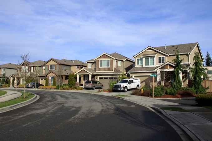
The Arbors at Harbour Pointe, a residential development next to the new urbanist Village Center. It was built under a planned residential development option under Mukilteo’s R-7200(S) zoning.
Unincorporated Snohomish County has differing zoning codes than Mukilteo and other cities. For example, duplexes can be built in single-family zones in unincorporated areas, but can only be built in multifamily zones in the cities. Detached condos can be built in most residential zones.
Under Mukilteo zoning, building standards are different compared to the unincorporated areas. Only single-family houses can be built in single-family zones, and detached condos cannot be built in any zone. Existing developments are grandfathered in by default, or in other words treated as legal but non-compliant. City zoning codes take greater account of a proposed development’s impacts to their surroundings, including ecologically sensitive areas and existing developments.
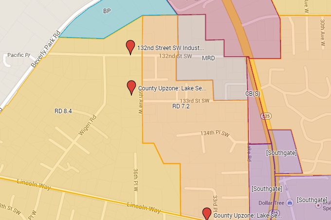
Section of proposed zoning map, created using Google My Maps
Unincorporated Snohomish County zoning is a hodgepodge of zones right next to each other, and much of it is because of spot rezones for lots. For example, a single parcel in a large area zoned for single-family residential could be rezoned to Low Density Multiple Residential (LDMR) on request by a developer. Another example is when the county zones a parcel for multi-story apartments, even though it’s surrounded by single-family houses and duplexes. This clearly won’t work well nor end well.
(Note: For planning purposes, the zoning map includes the entirety of Mukilteo’s Municipal Urban Growth Area, including areas not in this proposed annexation such as most of Fairmount. See the annexation area map for the proposed annexation boundaries.)
The zoning map used for this proposal for the annexation area is partially based on Mukilteo’s 2012 zoning map [JPG, PDF], which includes the city’s visioned zoning for the unincorporated areas. In addition, this proposed zoning map takes account of current and ideal development, development potential, the locations of ecologically sensitive areas and steep slopes, and the presence of adequate transportation facilities.
Land in Picnic Point and western Lake Serene would be mainly zoned for single-family housing. Land in eastern Lake Serene would also be mainly zoned for single-family housing, with some zoning for denser houses and smaller multifamily near Mukilteo Speedway and State Route 99. This is largely the current case, but with changes to focus density in more central areas instead of spreading it out into suboptimal locations. The rezones would be a mix of downzones and upzones.
The potential “South Gateway” area north of the SR 99/Mukilteo Speedway intersection is given a special zoning designation which would be later refined with further input. Overall, this area would be upzoned.
The commercial/industrial areas next to Mukilteo Speedway to the east would remain zoned for commercial/industrial development.
This zoning map is a working document and can be modified based on comments, and on suggestions for changes and modifications.